Fagaras Mountains
Fagaras Mountains
Romania's highest massif, the Fagaras Mountains line up eight peaks over 2,500 m, glacial lakes and the spectacular Transfăgărășan road.
The Fagaras Mountains form the highest chain of the Southern Carpathians in Romania. This granite massif stretching over 70 km long lines up eight summits exceeding 2,500 m, including Moldoveanu (2,544 m), the country's highest point. Glacial lakes, jagged ridges and deep valleys make it Romania's premier high mountain destination.
Why visit the Fagaras Mountains
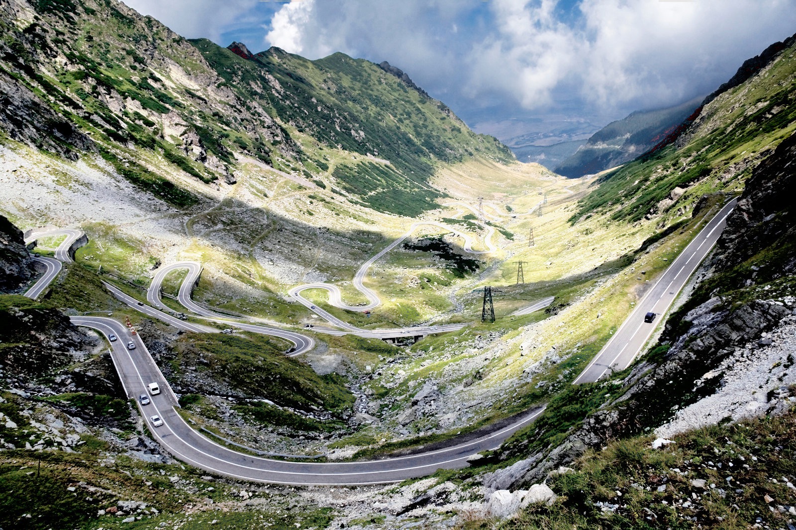
The Fagaras concentrate what Romania offers at its most alpine: severe terrain, few high-altitude settlements, mountain refuges scattered along the main ridge, and wild fauna including brown bears, wolves, chamois and lynx. The massif is traversed by the Transfăgărășan road, one of Europe's most spectacular scenic routes, which crosses the chain through a tunnel above 2,000 m elevation.
Unlike the more touristy Bucegi or Piatra Craiului massifs, the Fagaras retain a raw character. The trails demand commitment, reaching the summits often requires several days of hiking, and weather conditions can shift rapidly. It is this dimension that attracts experienced hikers and lovers of unspoiled landscapes.
What to see and do in the Fagaras Mountains
Lake Balea and its surroundings
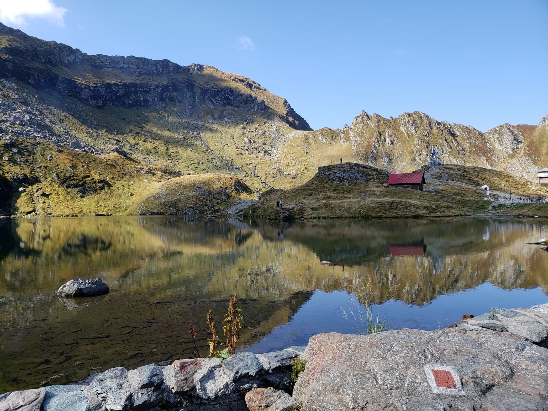
Lake Balea is a glacial lake situated at 2,040 m elevation in the Fagaras Mountains, the highest peaks of the Southern Carpathians in Romania. Directly accessible by the Transfăgărășan in summer and by cable car from Balea Cascada station the rest of the year, it is the most frequented access point to the massif. The lake is surrounded by rock faces and serves as a base for several hikes toward the ridges.
The major summits
- Moldoveanu (2,544 m): Romania's highest peak, accessible in two to three days from the Sambata valley.
- Negoiu (2,535 m): the massif's second summit, renowned for its exposed final ridge.
- Vistea Mare (2,527 m): junction point on the main ridge, often combined with Moldoveanu.
- Vanatoarea lui Buteanu (2,507 m): summit accessible from Lake Balea, a day's hike for trained hikers.
The complete ridge traverse
The massif's flagship route consists of traversing the main ridge from west to east, generally between 5 and 8 days depending on pace and variations. The route links refuges and bivouacs, with technical passages equipped with chains and cables. This traverse is considered one of the most demanding in the Carpathians.
Glacial lakes and valleys
Beyond Balea, the massif contains some thirty glacial lakes nestled in high-altitude cirques: Capra, Podragu, Avrig, Urlea, Bâlea Mare. The northern valleys (Sambata, Arpaș, Ucea) shelter Orthodox monasteries and ancient forests, while the southern slope descends toward the Olt basin.
Fauna and flora
Part of the massif is protected within the nearby Piatra Craiului national park and several reserves. Forest covers the slopes up to about 1,800 m (beeches, spruces), then gives way to rhododendron heath and alpine meadows. The region concentrates one of Europe's highest densities of brown bears.
When to go
The peak hiking season extends from late June to mid-September, the period when high-altitude passages are snow-free and refuges are open. The Transfăgărășan is generally passable only from July to October, closed by snow the rest of the year.
Outside summer, the Fagaras become demanding winter mountaineering terrain, reserved for equipped and experienced persons. The Balea cable car operates year-round (weather permitting), allowing lake access in winter for short outings.
How to get there
The massif extends between the regions of Sibiu, Brașov and Argeș. The main entry points are:
- Sibiu: international airport, starting point toward the northwest slope and the Transfăgărășan.
- Brașov: access to the northeast slope and the Sambata and Ucea valleys.
- Curtea de Argeș: entry from the south, along the Transfăgărășan.
A car is necessary to reach most trailheads. Seasonal shuttles connect certain villages to refuges in summer.
Practical information
- Required level: good to very good for ridge routes. Day hikes exist from Balea for less experienced hikers.
- Mountain accommodation: refuges (cabanas) distributed along the ridge, to be booked in high season. Camping is permitted in certain areas.
- Equipment: mountain boots, windproof and warm clothing even in summer, sufficient water (rare sources on the ridge).
- Safety: changeable weather, frequent afternoon storms. Plan extra time and descend early.
- Maps: Schubert & Franzke or Dimap topographic maps recommended.
Nearby attractions
- The Transfăgărășan road, which crosses the massif from north to south.
- The ASTRA Ethnographic Museum in Sibiu, one of Europe's largest open-air museums.
- Corvin Castle in Hunedoara, a major Gothic stronghold in Transylvania.
- The Creasta Cocosului geological reserve, another emblematic mountain site in the north of the country.
Frequently asked questions
Frequently asked questions
Moldoveanu, at 2,544 m, which is also Romania's highest point.
Not required for simple marked routes around Lake Balea, but recommended for ridge traverses and technical climbs (Negoiu, Moldoveanu) due to exposed terrain and weather conditions.
No. The high-altitude section is closed from autumn to early summer, generally passable from July to late October depending on snowfall.
Yes, the Romanian Carpathians are home to one of Europe's largest brown bear populations. It is important to follow local guidelines: do not leave food around refuges and make noise in forested areas.
Plan for 5 to 8 days depending on pace, weather conditions and variations chosen to reach secondary summits.
Planning your trip
The Fagaras Mountains fit naturally into an itinerary combining Transylvania and Wallachia. To build a tailored trip including hiking, Saxon villages and cultural sites, consult our Romania travel itineraries.
Interested in this visit?
We can include it in your personalised itinerary.