The Transalpina Route
The Transalpina Route
The Transalpina (DN67C) crosses the Southern Carpathians up to 2,145 m. History, stages, seasonality and practical access.
The Transalpina (DN67C) is Romania's highest paved road. Over 146 km, it crosses the Southern Carpathians connecting Oltenia to Transylvania, with its highest point at 2,145 m at Pasul Urdele pass. Nicknamed "Drumul Regelui" (the King's Road), it traverses rare high-altitude plateaus in Eastern Europe and constitutes, between June and October, one of the country's great driving routes.
Why drive the Transalpina
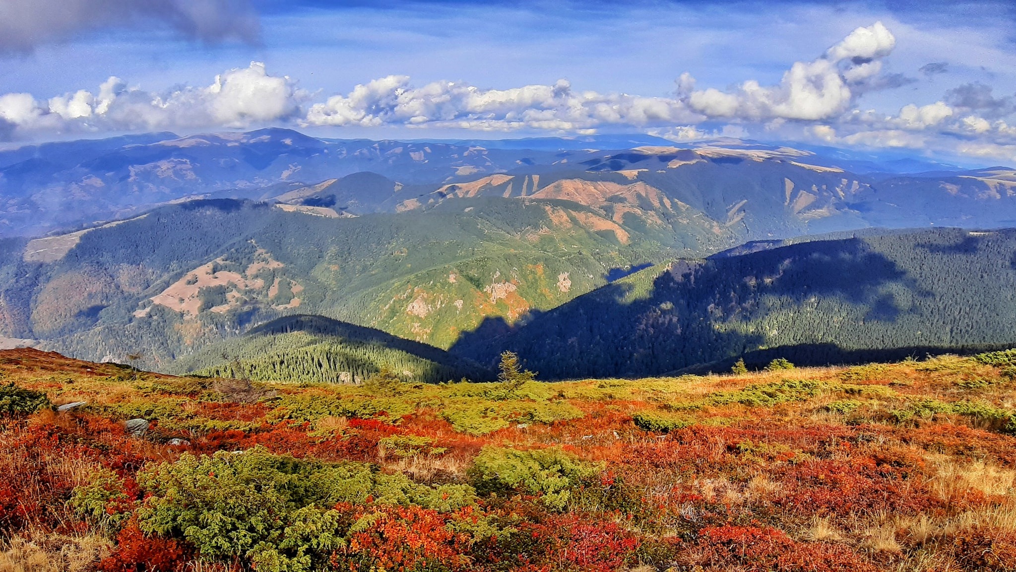
Unlike the more internationally known Transfăgărășan, the Transalpina retains a rawer, less-travelled character. The route winds across long grassy plains above the tree line, offering sweeping views of the Parâng, Lotru and Cindrel massifs. The road crosses summer pastures, sheep herds and several reservoir lakes, in a landscape where altitude dominates for dozens of kilometres at a stretch.
The route appeals equally to drivers, motorcyclists and experienced cyclists, drawn by the succession of hairpin bends and steep gradients in the central section.
History of the King's Road
The exact origin of the route is debated: local tradition evokes an ancient path across high-altitude pastures, used over the centuries by transhumant shepherds. The modern road, however, is associated with the reign of Carol II. Inaugurated in 1938 at Poiana Sibiu by King Charles II, it earned the nickname "Drumul Regelui" from that era onwards.
During the Second World War, the axis was taken over and rebuilt by German troops for military purposes, owing to its strategic position between the northern and southern Carpathians. Left in poor condition after the war, it underwent a major renovation project starting in 2007, covering around 148 km of roadway and modernising most of the route, now fully asphalt from north to south.
What to see along the route
The crossing is generally made from south (Novaci, in Oltenia) to north (Sebeș, in Transylvania), or vice versa. Several stops are worth your time:
- Rânca: mountain resort at around 1,600 m, the classic starting point on the southern side, with accommodation and viewpoints over the Gilort valley.
- Pasul Urdele (2,145 m): the road's highest point, on an open plateau. Rest area with views over the Parâng summits.
- Obârșia Lotrului Plateau: high-altitude crossroads at the junction with DN7A, surrounded by conifer forests.
- Oașa Lake: artificial reservoir with turquoise waters in the Sebeș valley, ideal for photography and short walks.
- Tău Lake and the final descent to Sebeș, where the road drops through gorges and Saxon villages.
When to go
Seasonality is the key factor. The high-altitude section between Rânca and Obârșia Lotrului is officially closed in winter, typically from late October/early November to early June, due to snow and avalanche risk. Barriers remain in place until snow clearing is complete.
- June: progressive opening, green landscapes, residual snow patches at altitude.
- July-August: peak season, optimal conditions but increased weekend traffic.
- September-mid-October: autumn colours on the forested slopes, lighter traffic.
Mist is frequent in late afternoon on the ridges: an early start is recommended.
Practical information
The road is fully asphalted but narrow in places, with tight bends and few guardrails on the most exposed sections. Gradients reach 8 to 10% on certain climbs. Plan for a vehicle in good condition, reliable brakes and a full tank before setting off: there are no fuel stations between Novaci and the Obârșia Lotrului area. Mobile coverage is intermittent at altitude.
Allow 4 to 6 hours to cover the entire route without stopping, but the crossing easily takes a full day with photo breaks and short walks.
How to get there
Two main entry points:
- From the south: Novaci, accessible from Târgu Jiu (around 1 hour's drive). From there, climb to Rânca then Urdele pass.
- From the north: Sebeș, on the Sibiu–Alba Iulia axis, close to the A1 motorway. A good starting point if you combine the Transalpina with a visit to Sibiu.
No public transport covers the entire route: a rental car or organised tour remain the practical options.
To combine in the region
The Transalpina fits naturally into a Transylvania circuit. To the north, in Sibiu, the ASTRA Ethnographic Museum offers a deep dive into Romanian rural architecture across a vast open-air site. Further on, in Maramureș, the wooden churches of Ieud and the Romanian Peasant Woman Museum at Dragomirești extend your discovery of mountain heritage. For another mountain experience, the Creasta Cocoșului geological reserve rounds off a Carpathian-focused itinerary nicely.
Frequently asked questions
Frequently asked questions
No. The high-altitude section is closed in winter, typically from late October to early June. Exact dates depend on snow conditions; it's advisable to check the opening status before departure.
The Transfăgărășan is more dramatic in its hairpin bends and more well-known, the Transalpina is higher, longer and traverses vast high-altitude plateaus. The two complement each other if your itinerary allows.
Yes for motorcycles—the road is highly popular with bikers in summer. By bicycle, the route is demanding (significant cumulative elevation) and reserved for trained cyclists; an MTB or gravel bike is preferable for the verges.
Accommodation is concentrated at Rânca in the south and around Obârșia Lotrului. On the high section, services are sparse: it's better to book ahead in July-August.
Extend your journey
The Transalpina fits naturally into a circuit connecting Transylvania, Oltenia and Maramureș. To build a complete itinerary across Romania, explore our Romanian journeys.
Interested in this visit?
We can include it in your personalised itinerary.