Parâng Mountains
Parâng Mountains
A granite massif in the southern Romanian Carpathians, Parâng peaks at 2,519 m and harbors glacial cirques, high-altitude lakes and long ridge traverses.
The Parâng Mountains form one of the highest massifs of the southern Carpathians in Romania. Situated between the Jiu and Lotru valleys in the south of the country, this granite massif stands out for its characteristic rocky amphitheater, glacial lakes and a main ridge that peaks above 2,500 meters at Parângul Mare summit. Less frequented than the neighboring Retezat massif or the Făgăraș range, Parâng remains a cherished hiking terrain for experienced walkers and skiers alike.
Why visit the Parâng Mountains?
Parâng belongs to the central group of the Romanian Carpathians and displays geomorphology typical of glacial reliefs: cirques, sharp ridges, high-altitude lakes. The massif appeals to three distinct audiences: hikers seeking long ridge traverses above 2,000 meters, alpine botany enthusiasts drawn to the richness of its alpine meadows, and skiers who frequent the Parâng resort above Petroșani.
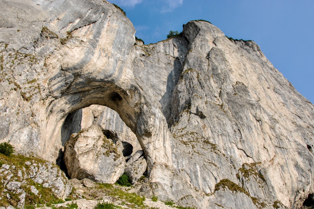
The Parâng rocky amphitheater, a characteristic geomorphological formation of the massif, traces a wide arc of glacial cirques descending southward. It is within these cirques that most of the glacial lakes with their signature turquoise hues nestle, earning the massif its reputation.
What to see and do in the massif
Summits of the main ridge
The main ridge stretches east to west and features several peaks exceeding 2,300 meters:
- Parângul Mare (2,519 m): the massif's highest point and one of the highest summits in the Romanian Carpathians.
- Gemănarea (2,426 m) and Cârja (2,405 m): peaks accessible from the central ridge.
- Parângul Mic (2,074 m): the massif's gateway from Parâng resort, reachable by chairlift.
Glacial lakes
Parâng is home to around twenty glacial lakes, clustered mainly in the cirques of the northern slope. The most renowned are Lake Câlcescu (the largest and designated a scientific reserve), Lake Roșiile and the Mija lakes. Many can be reached on foot from the main ridge as day-hike alternatives.
Flora and alpine meadows
Above the forest line, alpine meadows harbor flora characteristic of the southern Carpathians: Rhododendron myrtifolium (Carpathian rhododendron) painting the slopes in June-July, gentians, and more rarely edelweiss in protected rocky zones. The forest cover at lower elevations blends beech, fir and spruce stands.
When to go?
The hiking season spans from late June to mid-September. Outside this window, snow persists on the ridges and high-altitude routes demand winter equipment and experience. July and August offer the most stable conditions, though afternoon thunderstorms—typical of Carpathian reliefs—are common: an early start is essential.
For skiing, Parâng resort generally operates from December to March depending on snowfall. Alpine flower enthusiasts should target late June and early July, peak bloom time for Carpathian rhododendron on slopes above 1,800 meters.
Practical information
- Equipment: high-ankle hiking boots, windproof and waterproof clothing, ample water (water sources are scarce on ridges), topographic map of the massif.
- High-altitude accommodation: a few mountain refuges and huts (Rusu cabin, Groapa Seacă cabin) punctuate the routes. Booking ahead is advised during high season.
- Trail markings: routes are marked according to the Romanian system (colored bands and symbols on white background).
- Difficulty: a complete ridge traverse requires 3 to 5 days and solid mountaineering skills. Shorter loops are possible from Parâng resort.
How to get there
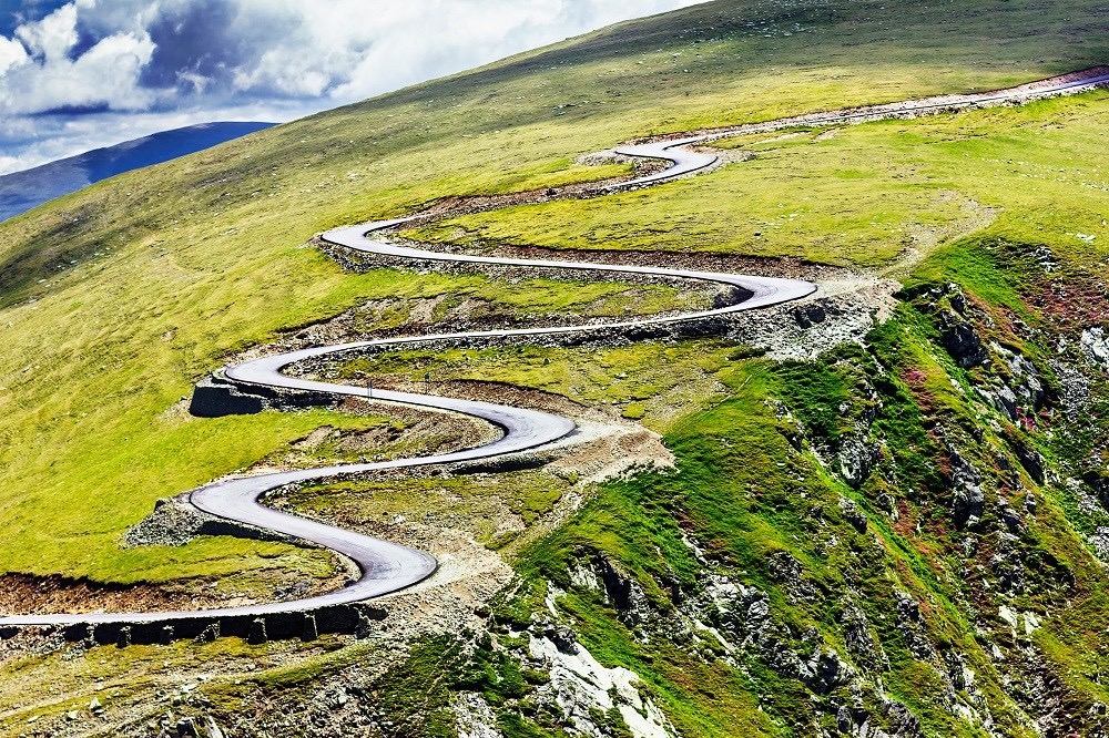
The massif's primary gateway is Petroșani, a mining town in Hunedoara County, accessible by train from Bucharest, Sibiu or Cluj-Napoca. From Petroșani, a road leads to Parâng resort (approximately 7 km), where a chairlift provides rapid access to higher elevations. From the east, the massif is also accessible via Novaci in Gorj County, using the Transalpina alpine road (DN67C), one of Romania's highest drivable mountain passes.
Worth seeing nearby
The south-western Transylvania and Oltenia region holds several sites to combine with a Parâng visit: the neighboring Retezat massif and its national park, the fortified city of Alba Iulia, or traditional Maramureș villages further north for extended cultural exploration. For rural heritage, the ASTRA Ethnographic Museum in Sibiu offers comprehensive insight into Romanian vernacular architecture. Heritage enthusiasts may detour to the wooden churches of Ieud.
Frequently asked questions
Frequently asked questions
Parângul Mare rises to 2,519 meters. It is the massif's highest point and one of the tallest summits in the Romanian Carpathians.
For short marked trails starting from Parâng resort, a guide is not essential if you are equipped and self-sufficient in mountain terrain. However, for multi-day ridge traverses or hiking outside the summer season, hiring a local English-speaking guide is recommended.
Yes. Retezat lies immediately to the west, and the Transalpina alpine road connects Parâng to the Lotru massif and Făgăraș further east. A one to two-week loop through the southern Carpathians is entirely feasible.
The resort offers runs for all skill levels but remains modest in scale compared to Poiana Brașov or Sinaia resorts. It suits intermediate skiers and those seeking guided off-piste experiences well.
Plan your Romania trip
The Parâng Mountains integrate seamlessly into an itinerary blending hiking, traditional villages and historic Transylvanian cities. To craft a bespoke journey combining Carpathian wilderness and heritage, explore our Romania travel suggestions.
Interested in this visit?
We can include it in your personalised itinerary.